


Description
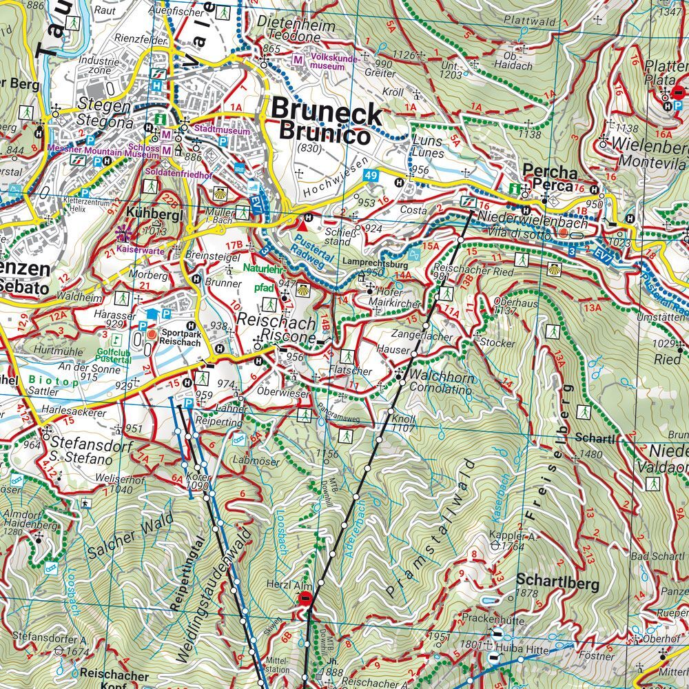
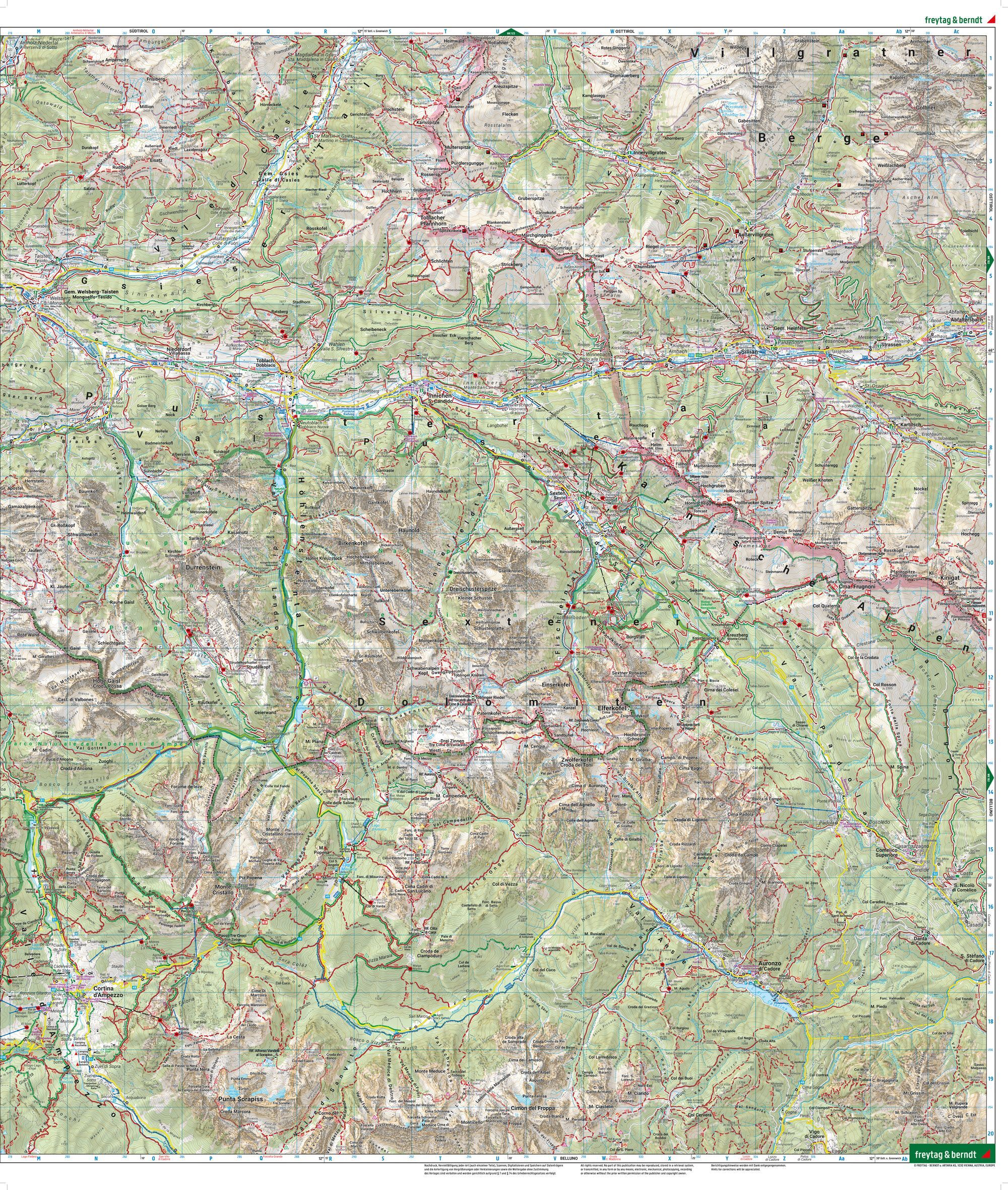
This detailed map covers Pustertal and the Dolomites in the border area between Austria and Italy, providing a thorough overview of an alpine landscape with mountains, valleys and well-known natural areas. The map has been developed for active use and is suitable for both planning and carrying out trips in the region.
The map shows an extensive network of marked hiking trails, long-distance routes and cycling routes, including both classic hiking routes and mountain bike trails. This makes it easy to plan trips in different parts of the area, whether you want short day trips or longer stages. In addition, tourist information and relevant points such as cabins, viewpoints and nature experiences are integrated into the map, providing good support along the way.
The map also contains information about winter activities such as ski trails and routes, and can therefore be used all year round. It is printed on durable, waterproof and tear-resistant material, making it well suited for use in demanding weather conditions in the mountains. The clear cartography provides a high level of detail and good readability in complex terrain.
Release year: 2024.
