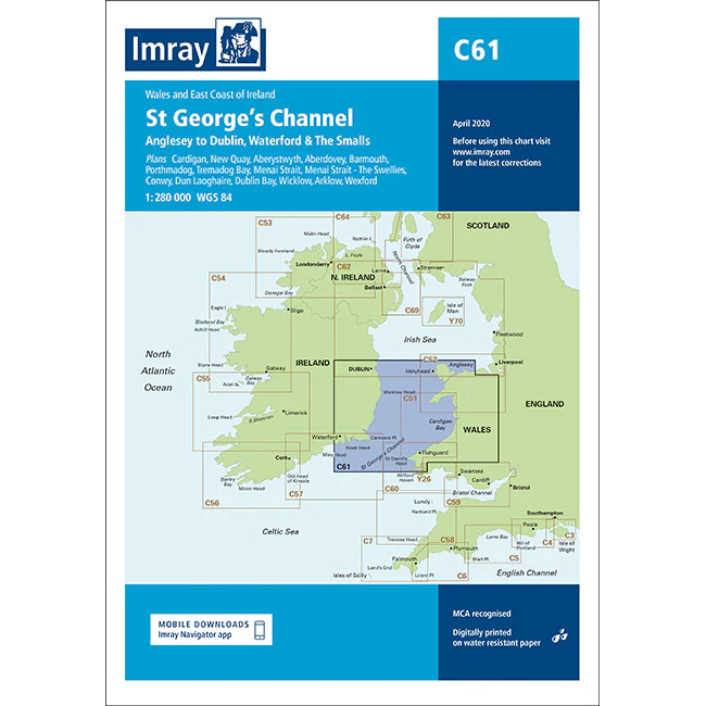
Description
This boating chart covers the St George’s Channel between Wales and Ireland, including the waters from Anglesey to Dublin and the area west of The Smalls. The chart has been developed for recreational boating and sailing navigation in an area characterized by open stretches of sea, strong tidal currents and important transit routes between the Irish Sea and the Atlantic Ocean.
The map provides an overview of coastlines, major approaches, sea areas and general sailing routes, and is suitable for route planning and overview navigation when crossing between Ireland and the UK. It is often used in combination with more detailed coastal and harbor charts for safe navigation in the area.
Imray is a renowned British chart manufacturer with extensive experience in nautical charts and publications for leisure boats. Designed for practical use on board, their charts combine clear cartography with reliable nautical information for sailors and powerboaters.