Description
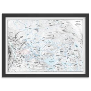
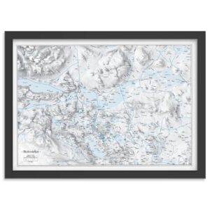
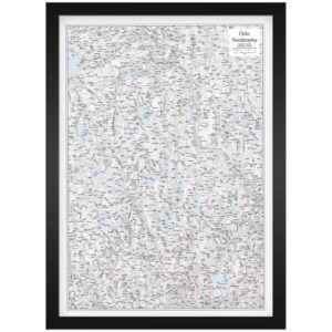
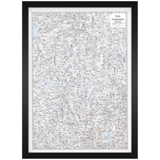
Wall Map Oslo Nordmarka is an exclusive and frame-friendly hiking and field map at a scale of 1:60,000 that provides a detailed and clear representation of Nordmarka in Oslo and Viken. The map shows paths, ski trails, water, heights, cabins and the boundary of Nordmarka, and is produced with discreet terrain shading that gives the landscape depth and a clear three-dimensional feel. This provides good legibility and a calm, aesthetic expression.
The map comes unframed, but in a fixed and frame-friendly poster format of 50 × 70 cm (portrait), making it easy to frame as desired. The balanced level of detail makes the map very suitable both as a practical reference for trip planning, skiing and cycling, and as a decorative wall map in the home, office or cabin.
The map is released in 2025. Although some details in the network, routes or buildings may have changed since publication, Veggkart Oslo Nordmarka still provides a very good and inspiring overview of the area and works well as both an orientation map and an atmospheric wall map.
For those looking for maps in other formats, styles or presentation solutions, we also offer a wide range of print-on-demand map products on kart.no.