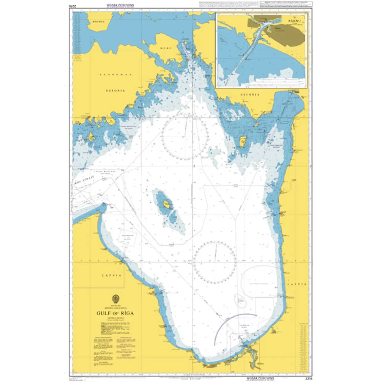
Description
This British Admiralty chart covers the Gulf of Riga in the Baltic Sea, including the coastal areas along Latvia and Estonia and the approaches to major ports in the region. The chart shows depths, shoals, navigation marks, traffic lanes and other important details for safe navigation in relatively shallow and busy waters.
The chart is well suited for coastal navigation, transit and voyage planning within the Gulf of Riga. Developed for professional navigators, it provides a reliable chart basis for vessels operating in the area, both for scheduled and commercial traffic.