Description
This nautical chart covers River Fal and the areas around Falmouth in South West England. It is part of Imray’s Y-series, which consists of detailed single maps for selected areas, and is suitable for both local navigation and as a supplement to larger map packages.
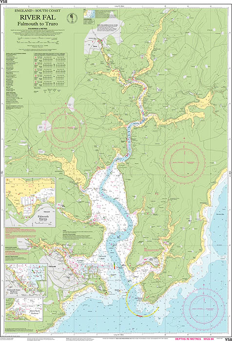
The map provides a detailed depiction of the approach to River Fal and further up the river, including port areas, marinas and anchorages. The area is known for its good natural harbors and safe anchoring conditions, and the map provides the necessary information for safe navigation in a varied and partly narrow waterway.
The map is printed in large format (640 x 900 mm) and comes folded to A4 in a sturdy plastic folder. The water-resistant material makes it well suited for use on board in various weather conditions. The cartography is clear and detailed, with a focus on navigation information that is particularly useful for leisure boats.
The map includes the following coverage: the approach to the River Fal from the coast and further up the river course with navigational details. Also included are detailed harbor plans for Falmouth Yacht Marina, Falmouth Inner Harbour and Mylor Yacht Harbourwhich provide good support for berthing and maneuvering.
This is a specialized map that provides an excellent overview of one of the most important sailing areas in Cornwall, and is particularly useful for sailors who want detailed coverage of ports and river areas.
Release year: 2021 (updated to 2024).