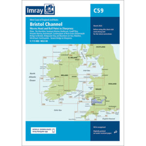
Description
This boating map covers the coastline from Trevose Head in Cornwall to Bull Point in Devon, along the west coast of England. The area includes open coastal waters, exposed headlands and key approaches to ports and estuaries used by both recreational and commercial boaters.
The chart is well suited for route planning and overview navigation for coastal cruising in the Bristol Channel area and along the southwest English coast. It provides a clear representation of coastlines, fairways and the main features of navigation, and is often used in conjunction with more detailed Imray charts for ports and local waters.
Imray is a renowned British chart manufacturer with extensive experience in nautical charts and publications for leisure boats. Their charts are developed with a focus on practical on-board use, combining clear cartography with reliable nautical information for sailors and powerboaters.