Description
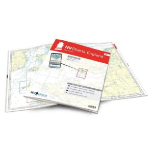
NV Charts England UK3 The Solent is a complete chart package with paper charts and digital nautical charts covering the famous sailing area The Solent on the south coast of England. The charts are based on official data from the United Kingdom Hydrographic Office (UKHO) and provide up-to-date navigation information for sailing in the area between Southampton and the Isle of Wight.
The charts provide detailed navigational information on water conditions, approaches, ports, depths and anchorages. The clear cartography makes it easy to find harbors, anchorages and key navigation points both on paper charts and in the NV Charts app.
The chart set is delivered in atlas format with clear cartography, combined with digital access via the NV Charts app or PC/Mac. The digital charts can be used offline, so you always have access to up-to-date navigation data both when planning at home and out at sea.
Sailing area
UK3 covers the Solent, the strait between Southampton on the mainland and the Isle of Wight. The area is known as one of the best sailing areas in England, but is also characterized by strong tidal currents that make navigation exciting.
Summer brings a lot of boat traffic, especially as Southampton is one of the largest ports in the UK and is visited by many cruise ships. The sailing community is very active and every two years the famous Fastnet Race regatta starts from Cowes on the Isle of Wight.
The Isle of Wight is renowned for its distinctive limestone cliffs that stretch across much of the island. The iconic rock formations of The Needles on the western side of the island are one of the area’s most famous landmarks.
Characteristics
Paper maps in atlas format with a high level of detail and good overview.
Digital access via the NV Charts app with offline use on multiple devices.
Detailed navigation information for the waters in and around The Solent.
Port plans, approaches, shipping lanes and anchorage areas in the area around Southampton and the Isle of Wight.
Based on official data from the United Kingdom Hydrographic Office (UKHO).
This map set contains
3 overview map for sailing
8 site map
25 detail map
Digital charts for navigation software and the NV Charts app (356 day license)
Navigation instructions in English
Tide tables
Port plans on paper and digitally
Meets the requirements for updated paper charts on board
Updates
The maps are always delivered in the latest available edition from NV Charts. If a new and updated edition is launched within 30 days of purchase, the map can be exchanged for a new edition free of charge.
EAN / ISBN
9783910644335