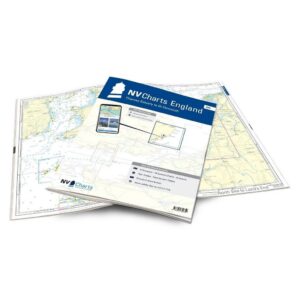
Description
NV Charts England UK5 Thames Estuary-Great Yarmouth is a complete chart package of paper and digital charts covering the east coast of England from the Thames Estuary to Great Yarmouth. The charts are based on official data from the United Kingdom Hydrographic Office (UKHO) and provide up-to-date navigation information for sailing along the Essex and Suffolk coasts.
The charts provide detailed navigational information on water conditions, approaches, ports, depths and anchorages. The clear cartography makes it easy to find harbors, anchorages and key navigation points both on paper charts and in the NV Charts app.
The chart set is delivered in atlas format with clear cartography, combined with digital access via the NV Charts app or PC/Mac. The digital charts can be used offline, so you always have access to up-to-date navigation data both when planning at home and out at sea.
Sailing area
UK5 covers the English east coast from the Thames Estuary north to Great Yarmouth. The area is particularly relevant for sailors crossing the North Sea between the Netherlands and England.
The map set includes the coast of Essex and Suffolk as well as important ports and sailing areas along this part of England. Cities included in the atlas include Harwich, Ipswich and Lowestoft.
The area also offers good opportunities for further sailing north along England’s east coast towards Scotland, or for crossing back to the Netherlands and the continent.
Characteristics
Paper maps in atlas format with a high level of detail and good overview.
Digital access via the NV Charts app with offline use on multiple devices.
Detailed navigation information for the waters along Essex and Suffolk.
Port plans, approaches, shipping lanes and anchorage areas along the east coast of England.
Based on official data from the United Kingdom Hydrographic Office (UKHO).
This map set contains
3 overview map for sailing
16 site map
16 detail map
Digital charts for navigation software and the NV Charts app (356 day license)
Navigation instructions in English
Tide tables
Port plans on paper and digitally
Meets the requirements for updated paper charts on board
Updates
The charts are always delivered in the latest available edition from NV Charts. If a new and updated edition is launched within 30 days of purchase, the map can be exchanged for a new edition free of charge.
EAN / ISBN
9783910644359